

The decline of an entrepot - Calicut
Posted by Labels: Calicut floods, Calicut port decline, Calicut water levelsAs water levels rose 1585-1700
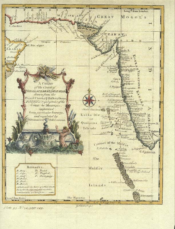
Many years ago, I wrote about the sunken ruins of Calicut, as observed by Forbes and some others, and tried to discount the myth of a sunken city. But after Nikhil’s comment, the topic did not leave my mind and I continued to search for information, mainly because more than a couple of eyewitnesses had recorded seeing underwater structures. While change could have happened gradually, it is obvious that a cataclysmic event did not swallow large tracts of the Calicut shoreline. At that time, we checked out major events and found that there were some minor earthquakes and tsunamis, but nothing of great importance. Nevertheless, it is now clear that there was a gradual rise in the coastal water levels and that major structures went underwater, affecting not only the geography of one of the most active ports of medieval times, but also its allure and popularity, resulting in alarmed traders leaving the port city. There is no doubt that there were other overriding political and economic reasons as we discussed on previous occasions, but the infrastructure issues were also an underlying reason. Let’s take a look.
While geographers and cartographers can someday ascertain all
this with more detailed underwater exploration, I can try and reconstruct the
gradual events after reviewing anecdotal evidence provided by a number of
travelers. If you were to ask a deeply religious and slightly pessimistic, grumpy
grandpa about it, you would get an answer, yes! Indeed, that is of course the
prophecy from our scriptures, that during the Kali yuga, all these chaotical
events are bound to happen, so if parts of land (which had anyway been
reclaimed by Parasurama) went under water, it is natural.
Perhaps it was around the late 16th century or
the early 17th that things started to go wrong and water levels
crept up, swallowing roughly 2-3 miles of the shoreline, especially parts of
the city which had previously been allocated to the foreigners and the trading
communities. We can find in following paragraphs how the Portuguese, French and
British were affected, perhaps even the remaining Chinese, forcing them to move
to better environs, up North in Goa, East to Madras, North west to the Konkan
ports, Surat and eventually Bombay.
Interestingly it was the French who first observed and
documented the pattern of events. The first mentions can be seen from the
accounts of Souchou de Rennefort who stayed in Calicut in 1667. He explains that
the Town of Calicut is in a plain, without order and symmetry. There are
houses in the spread of sixteen leagues around, among the coconuts, like the
bastides around Marseille in the vineyards and in the fig trees. Most of them had
thatched roofs in the shape of very large pavilions & very clean inside, but
lower than those of Cochin (I will cover this account in greater detail
separately, but will be focusing mainly on the rising waters in this article).
The market functioned every day from afternoon until seven. Covered shops lined
up from one end to the other, & behind each there was a room where the
goods were stored. Cotton fabrics, white & colored, Muslin, Pepper, Pulses,
Coconut Oil, Sapan wood for dyes, coir ropes, etc. were all on offer. The
Samorin is mostly at his home in Cranganore, sixteen leagues from Calicut,
& five from Cochin. But Rennefort does not make any mention of rising
water lines or a sunken Portuguese fort. Another Frenchman, Francois Martin who
was in Calicut at the same time, makes it clear that the Portuguese fort was indeed
submerging and nearly a mile into the sea, by then.
The last of the accounts about the rising waters can be seen
from Dellon’s diary. We had covered very briefly Charles (Claude) Gabriel
Dellon’s visit in a couple of articles, but I had not gone into the description
of the city in greater detail. Dellon, a surgeon, is very specific in his
description of the situation in Calicut, which he visited in 1678. Dellon
mentions that the fort was 2 leagues or 7 miles into the sea just ten years
later, which maybe an overestimation, since others state 2 miles, not 2 leagues.
He explains - All about Calicut there are very low grounds,
subject to frequent inundations, there being scarce a year but some part or
other of this Kingdom is laid under water, by the overflowing or the Rivers.
The Fort which the Portuguese formerly had built at a good distance from the shore,
may now be seen two leagues deep in the sea, above half under water, so that
you may frequently see small vessels pass betwixt that and the shore. These inundations
are caused by the strong South West winds, which blow on that coast
continually, from May till September. Whilst I was there, I was an eyewitness
of the disaster that befell the English whose habitations, which had not been
built many years before, were entirely swallowed up by the waters.
He adds this important observation - The frequent
mischiefs occasioned by these inundations, has been one of the main reasons why
the Foreign Trade has in a great measure removed from Calicut to Goa, which
City, has laid the foundation of its greatness upon the ruins of that of
Calicut.
Since the Kings of Samorin have removed their Court to
another place, there resides here a Governor (whom they call Bajador – Eralpad?)
in the Royal Palace, where there is as yet to be seen a very large Bell, and
some Brass Cannon, which were brought thither, after they had chased the
Portuguese out of their fort.
It is a considerable time since the English have been settled
at Calicut; but their habitations having been ruined (as we said before) by the
over flowing of the waters; they built another house in a rising (high ground) and
consequently less dangerous piece of ground.
We went the next day from Chali, and arrived the day
following early at Calicut, where we found the English busy in removing after
the late inundation; we travelled a league beyond it the same day, where we
lodged that night, and the next following at Bargara (Badagara), from whence we
returned the next day to Calicut.
According to Aniruddha Ray - This must have been the
first English factory which was engulfed by the advancing sea sometime between
1672 (Carre's arrival) and 1678 (Dellon's arrival). According to Dellon, the
English then constructed a new one at an elevated place, where he, along with
other French merchants, had dinner. It seems that flooding had begun after 1645
and continued upto the end of the seventeenth century. The submersion of a part
of the city by flooding may explain why Freyer's estimate of the circumference
of the city was less than of Conti, a century and half earlier. However, we
can also note later from the English factory records, that the rapid inundation
seems to have started with a violent storm in 1670 and continued for some time.
Ray also believed that the Zamorin’s palace observed and detailed by Delle
valle, Rennefort, Martin and Dellon is of a palace different from the one detailed
by Barbosa which indicates a move inward from the palace detailed and visited by
the Portuguese.
Let’s look at two English sources to nail the dates – that
from Charles Fawcett and a recent thesis by John Mason. We find from the
letters of the factors, that the situation had deteriorated, the Zamorin’s
powers had weakened, the Eralpad and Munalpad were wielding power and that the
Zamorin was away in other palaces much of the time. We also find that the
Moplah and Marakkar pirates were on the prowl on their own, with the Zamorin
not able to control their actions, all of which resulted in frequent Moplah
outbreaks. We can also observe some friction between the Zamorin and the 5th
prince. During the period between 1670 and 1677 AD, Calicut also witnessed an
epidemic of smallpox which frightened tradesmen. We can read that most of the
domestic servants of the English factories had contacted the disease and
ultimately three of them died.
Dr John Fryer visiting in 1680 provides a terrible review - On the back-side lay two great Guns, dismounted, of Brass, all that is extant of the Portugal Town and Castle (which ran out as far into the Sea as our Ships now ride, near four Miles) overflowed by Water; nothing remaining of it but only what is taken upon Chronicle. What is also left of Calicut, is not equivalent to what might be expected from the gleaning of so many Ages of Traffic; unless, as Antiquaries esteem, most of those things are Moth-eaten by Time, which Vermin has been plaguy pernicious here: For the City that stood upon Stilts, is tripped up, for down it is gone; and the Temple, whose Marble Pillars durst compare with those of Agrippa's in the Roman Pantheon, is Topsy-turvy. And if any one that comes after me, make you believe it to be not above Four Miles in length, and in that not a House befitting a Christian; here and there a Mosque, and Burying Places with Tanks: A good long Bazzar with Trash, and Ripe Fruit; another with Opium, and Spices of this Coast; Changers and Jewelers, unfenced and rude in Building; he tells you but the truth. Indeed, it is pleasantly situated under Trees, and it is the Holy See of their Zamorin or Pope.
 |
| Coote Reef where the sunken ruins were sighted |
The next account we see is from 1702 when an anonymous
letter sent to French chief Pliavoine asks him not to forsake Calicut, as it
has excellent possibilities despite the low beach, the need to anchor far away
in the open roadsteads and the advancing seas encroaching on the landline. The
Portuguese fort was two miles into the sea by now and mostly underwater, with
just some tower tops above the water. By this time the Zamorin as well as richer
merchants had moved their original places of residence.
British factory records provide some insight on the changes
which happened. From the Fawcett records and Mason’s thesis, we can see that
the first factory headed by Woolman, a gunner, three factors and a boy,
operated out of a rented house in 1617, belonging apparently, to the Zamorin.
Business was pretty poor, but it was restarted in 1659 only to close again in
1661. It was again started in 1664 and by 1665 a new custom-built two storied
house became the factory premise. In 1666 a subsidiary unit was established in
Tanore, when relations with the new Zamorin soured a bit. This Calicut factory was
apparently destroyed in the 1670 storm which swept the coastal parts of Calicut
and the factory again moved to a rented house, until 1675. Located apparently
at Tekkepuram and facing the beach, it must have been part of the buildings
depicted in the Barlow painting dating to 1670. Barlow’s sketch does show
portions of a tower, perhaps this is the second Chalium Portuguese fort (It has
to be, since the larger fort was submerged per Martin’s noting in 1667). In
fact, the 1670 records also record a letter from Mansell Smith reporting
exceptional stormy weather – the raging sea hath devoured great parte of
Calicut towne and also halfe the English factory soe that they must be forced
to looke for a new house or build another…
Hamilton stated that around mid Feb 1703, when he visited
Calicut, as he stood and looked, he chanced to see some of the ruins of the
sunken town (on Coote’s reef, off Calicut) and the remains of a fort built by
the Portuguese in former times. He is not sure if the town was undermined by
the sea or swallowed by an earthquake.
He states - " In anno 1703, about the middle of
February, I called at Calecut on my way to Surat, and, standing into the road,
I chanced to strike on some of the ruins of the sunken town built by the
Portuguese in former times. Whether that town was swallowed up by an
earthquake, as some affirm, or whether it was undermined by the sea, I will not
determine but so it was, that in 6 Fathoms at the main Mast, my Ship, which drew
21 Foot water, sat fast afore the Chess-tree. The sea was smooth, and, in a
short time, we got off without damage..."
The second dynasty of Zamorin’s takes over
One reason for the spurt in warring activity would have been
to potentially re-establish control and ensure that trade and power rested with
Calicut, where nervousness had been setting in due to the inundation issues,
Moplah revolts and perceived weakness in the ranks. We can clearly note from
British records that the relations between the Zamorins and the Moplahs of
Calicut had been deteriorating and frequent revolting and skirmishes were
recorded.
 |
| Barlow's Calicut |
Newbold confirms in 1846 that he saw the ruins of the Portuguese factory underwater as well. He states that local people mentioned of other underwater ruins some 12km north, towards Kappad.
Logan adds - The
Portuguese fort was abandoned during the hostilities in 1525 (Logan, 1887, p.
326), but its subsequent history remains unknown. If the fort had been
constructed on an estuarine sand bar it could easily have collapsed during an
erosional phase of the river or the sea, and its ruins might now be covered by
subsequent accretion. If these were the submerged ruins that Hamilton and
Stanhope encountered, the anchorage they would have used would have been much
different from that use today.
There is one other aspect to be noted, that the Chinese fort was located close to where the Portuguese fort once stood. So, if that were indeed the case, the Chinese fort would have also been submerged, so also their settlement and this must have been good reason for them to leave for better environs.
Forbes in 1772 confirms having seen underwater temples & minarets and explains all these in greater detail in his accounts. Forbes (A.D. 1772; Oriental Memoirs) on the coastal changes at Calicut:
“Calicut road where the ships anchor is deemed unsafe for those not well acquainted with the navigation, several vessels have been wrecked upon the ruins of the old city, now under water; as the mean town, just described, formed no part of the emporium where Vasco de Gama landed. Calicut is said to have been then a large city, where the Zamorin, the sovereign of the country, held a splendid court, and merchants resorted from Persia, Arabia, Africa and different parts of India to purchase pearls, diamonds, spices, ivory and other costly articles”
An article in the Calcutta review Vol 9 provides some
corroborating evidence, but relates to other parts of the West coast shorelines-
The level of the Malabar Coast appears also to have suffered disturbance.
The town of Barcoor, north of Mangalore, supposed by Rennell and Robertson to
have been the Barace of ancient Geographers, and the emporium of Indian
commerce; now stands two or three miles from the sea. Some of the cliffs
running parallel with the present coast, at some distance inland, have every
appearance of having been formerly washed by the sea and the Brahmans assert
that the whole of the Malabar Coast was elevated for their special use. The
island Vaypin near Cochin was thrown up from the sea in the fourteenth century,
an event which “had so strong an effect on the minds of the Hindus that they
marked the geological phenomenon by commencing from it the new era termed
Puduvepa (new introduction)."
Changes of a still more recent date seem to have occurred
on the Coromandel coast. The site of the old city of Calicut is now buried
beneath the sea, and it is said that the remains of an old factory are to be
seen in the surf off Purkaad, and those of Pagodas in the surf at Tricanapully
on the coast of Travancore. Cases of this sort however require to be better
established than they are at present, and we hope someone will adopt Captain
Newbold's suggestion for instituting observations on the faces of the cliffs
washed by the sea, after the example set by Celsius.
In a 1900 Report on the mud bank at Alleppy in Travancore,
Mr. Rhode, a former Commercial Agent of the State, observed: “I cannot give
dates as I have no records, but it is certain that the coast from about north
of Calicut to south of Quilon was once well above the level of the sea, and was
after a long period totally submerged and then again was thrown up by volcanic
action and has again been partially covered by sea. I state this because in
cutting the Warkalai Tunnel, trees were found, and also shells have been found
on the coast which are known to belong to a class of shellfish that only live
in the deep waters. Remnants of a fort at Poracaud were visible 30 years ago,
and at Calicut and Vypeen massive buildings are now in the sea.”
It is curious, says Dr. Day, “that this law of
encroachments of the sea is now the rule on the western coast, because
tradition and an examination of the geology of the country both lead to the
conclusion that the sea formerly washed up to the Western Ghats; thus, Malabar
has been literally raised from the sea.”
 |
| Forbes Calicut |
Barendse made this comment in his ‘Arabian Seas’ – The cities straddling the coast appeared almost as rural dwellings along the wide tracks lined with palms. Calicut – seat of the powerful Zamorin, was a quiet rural town that differed so markedly from the image conjured by its famous name that legend spread that the historic metropolis had disappeared into the sea. At low tide, it is said, one could discern the shapes of stately edifices at the bottom of the sea.
So, all in all, we can conclude that the sea erosion started
around 1585 and continued on, with marked regularity. Post 1645, we see written
records of rising water levels in Calicut and the flight of traders and of
rapid rise and inundation in 1670. This perhaps explains another reason why the
Zamorin himself moved off around 1645 to spend long durations at the Ponnani or
Cranganore kovilakom’s. While most researchers have mentioned that Ponnani was
the political or war capital of the Zamorin, Ray feels that his long absence
from the city of Calicut resulted in a loss of faith by traders due to this
absence as well as the sinking city’s decline to ‘just another market place’.
In the 18th century, the Mysore Sultans invaded
and by the turn of the century, ceded the entire region to the British. The
change in fortunes is amazing, the British operated off a rented house serving
as a factory at Calicut in 1670, with just three staff. In fact, they could not
even offer a decent dinner to a visiting pastor then, due to a lack of space
and resources. 200 years later, they were masters of the entire region.
One can thus conclude that approximately 8-12 square miles of
the old city was lost to sea, considering that the fort which had been built on
the shore had receded 2 miles into the sea, in 1670 when visitors chanced on
it. What of these Calicut ruins now? Not much would have been left since there
were every few buildings built of stone, and any mud housing would have been washed
away, or covered by mud banks.
References
The English
Factories in India – Charles Fawcett
Histoire des
Indes orientales, par M. Souchu de Rennefort- Urbain Souchu de Rennefort
A Voyage to the
East-Indies: Gabriel Dellon
A new account
of East-India and Persia, in eight letters being nine years travels begun 1672
and finished 1681 - Fryer, John
The English
factories of South West India – P M Mason
A History of
Kerala: Written in the Form of Notes on Visscher's letters from Malabar – KP
Padmanabha Menon
The French
presence at Calicut from mid-17th to the early decades of the 18th
century – Aniruddha ray
The Arabian
Seas: The Indian Ocean World of the Seventeenth Century: Rene J. Barendse
Travels in
India in the 17th CenturDr John Fryer
Historic alleys
– Sunken ruins of Calicut
Pics – Barlow’s Calicut – Royal Museum, Greenwich
4 comments:
Thank you for focusing on an issue that has not received sufficient attention. It is a fact that the Kerala coast is fairly 'young' according to geologists. They have reported that out of the 600 km of the shoreline, almost 320 km are affected by accretion and erosion. It is very likely that the old Calicut city is lying below the salty waters. In fact, our Forum tried to enlist the ISRO to do a satellite mapping of the Calicut coast and the National Institute of Oceanography to explore the coast, as Rao and company have done splendidly in the case of Bet Dwarka. But we admit, we did not succeed. Coincidentally, just last week a laterite structure which was sunken so far has surfaced in Fort Cochin as the sea receded. It is believed to be part of the Portuguese Fort, the first fortification by a European power in India. I hope your post will lead to serious exploration by the experts to unravel the lost city of Calicut.
Thanks CHF,
I recall a brief survey of the coastline was done by the British over a century ago, and recall some mud bank articles by some students, but a proper survey and exploratory survey should be done and I hope it gets done someday.
Very interesting.Let me add my lay comment here pl !
I hail from near Kayangulam, to be precise exactly 6 km due East of this town. My own home stands on whitish soft soil,the soil almost like beach sand. But right from this point,the soil changes to red ABRUPTLY,almost like the soil in high ranges ! It is as if an irregular line is drawn parallel to the present coastline and this line would represent the old coastline ! The distance to this line from the present coastline in Kayangulam could be upto 10 km.
Even as a child,I was baffled & convinced that the old coastline extended eastward by about 10 Km till some geographicl upheavel took place 1000s of years back !
Thks and Keep up your good work,Maddie !
Purakad and Trikkunapuzha mentioned here are my ancestral villages. Elders frequently say that many temples were submerged under the sea. I hope Kerala Government invest heavily in Underwater archaeology for bringing out the past glories of the state.
Post a Comment