

Travancore lines – a Reality Check
Posted by Labels: De Lannoy, Mysore Sultans, Tipu Nedumkotta, Travancore lines
The Nedumkotta fortifications - A discussion
The Travancore lines were according to some historians,
first planned by Marthanda Varma duly assisted by his general De Lannoy and built
by the Travancore troops in order to protect Travancore and Cochin from the
Zamorin’s attacks. Others mention that it was built by the succeeding
Dharmaraja for the same purpose, with De Lannoy’s supervision and that they were
further strengthened by Travancore to prevent any potential incursions by Hyder
and later, by Tipu Sultan. It became a bone of contention between the Mysore
Sultans and Travancore as well as the European powers, the Dutch and the
English. I had also written about the battle which took place later, but the question
in front of us is, who actually built these walls or lines? Was it built from
scratch by De Lannoy, as reported by Travancore historians such as Nagam Aiya, Velu
Pillai, Ulloor and many others? Or was history fudged a wee bit?
I certainly believed it was built from scratch by the
Travancore troops, until I read a detailed account by eminent Newspaper editor
and writer VT Induchudan. That source was what made me ponder over the matter.
So let’s proceed to verify if Marthanda Varma, Dharma Raja and De Lannoy were rightly
credited with the building of the Northern fortifications i.e. the so termed ‘impregnable’
Travancore Lines (Nedumkotta).
You know, most people are under the impression that the
Japanese were forced to surrender, after the atom bombing of Hiroshima and
Nagasaki. It suited the US stance and curiously the Japanese stance even though
the reality was that the surrender was forced when the Japanese noted that they
had lost an ally Russia, once and for all, and were isolated. Everybody
accepted the A bomb theory and the matter rested, save for the nice report
published in 2013 refuting this. Similar is the case of the Travancore lines,
for it briefly served its purposes of both the Mysore Sultans and a rising
Travancore.
So what did conventional wisdom state? In 1760 The Zamorin
invaded Cochin and overran Karurpada near Shornur. The Paliyath Achan was sent
to Travancore by the Cochin Raja to seek support after which a treaty was
signed in 1761 between Cochin and Travancore. Travancore troops were now sent
to aid Cochin and the first thing they undertook was the construction of the
famous Travancore lines, stretching in an almost straight line from the shore
of the backwaters opposite the town of Kodungallur to Pushpagiri at the edge of
the Western Ghauts. They consisted of an imposing earthen rampart, not very
high, extending over thirty miles in length from Palliport along a strip of
land which had been ceded by the Cochin Rajah. Just flanking their western
extremity were the Dutch forts of Cranganore and Ayacotta. The lines were
fronted by a ditch on the north. Flanking towers were placed at intervals, and
a fort was constructed at the western extremity. The construction of the
fortifications was entrusted to the Dalawa and General De Lannoy.
The lines resisted further advance of the Zamorin's troops. In
1762 the Travancoreans under the command of General De Lannoy formed into three
divisions and attacked the Zamorin's garrisons at Cranganore, Parur, and
Verapoly, with their right flank protected by their fortifications. The Zamorin
was defeated in a short time, and his troops were completely driven back from
Cochin territory. This event made Travancore according to Logan "master of the whole country from
Cranganore to Cape Comorin, a small isolated portion of territory lying round
the Cochin Raja's Palace at Tripunittura on the east of the backwater, and
another portion to the north and south of Cochin on the west of it, being all
that was left to the Cochin Raja of his dominions to the south of the
Travancore lines"
Later events took place when the Mysore Sultans were
ravaging Malabar and were expected to continue their incursions down south,
alarming the Travancore Raja. Cochin quickly signed a treaty with Tipu and
became his vassal. Travancore decided to fortify the so called Travancore
lines, extend it and went on to purchase two forts from the Dutch, the very
actions which infuriated the Mysore Sultans. I had written about the events
which followed, in this linked article.
In 1758, Marthanda Varma died; his successor was his nephew
Rama Varma, whose principal councilor was de Lannoy. Meanwhile, the Zamorin of
Calicut had also died and Travancore had concluded a peace treaty with them.
After the peace treaty, de Lannoy was commissioned to build a permanent defense
line to guard against all possible future invasions from Calicut. It was called
the Nedumkotta or the Travancore lines and was finished in 1775.
An unbiased survey report on the fortifications comes from
Connor’s and Ward’s survey of 1820 and I will publish it here so that it is
useful to researchers in future, rather than depending on various fanciful
descriptions.
The Military frontier
of Travancore may be considered as marked by the fortified lines passing
through the Southern part of the Codachayree (Kodasseri) District, the space
they occupy having been purchased by that state for the purpose of their
erection. It is not easy now to say what motives dictated the choice, for an
inspection of their position and the ground in its immediate vicinity will not
solve the difficulty. The lines occupying for the greater part the crests of a
series of slopes comparatively open and not remarkable for either elevation or
steepness. Commencing at Yellunjayree (Elavancheri), East of which the Hills
(frequently precipitous always high and woody) are supposed to afford a
sufficient defense, they run in an irregular course, their sinuosity arising
from the necessity of conforming to the ground over which they pass, though the
wall alike pursues its course over eminence and Valley for the wide extent of
twenty-four Miles, terminating at Jacotay, a name sometimes given to the whole
work, to which however the designation of Wettycotay more properly belongs,
independent of its extreme length which would require an army to defend, the
weakness of its profile and inequality of its construction is such as to offer
no barrier that could prevent or scarcely retard invasion. The Fortification
consists of a rather strong embankment and Parapet of Earth, the whole height
not measuring on the average (for the elevation is not always the same) above
fifteen feet at most ; the Ditch may generally be about half that depth, nor
does its breadth exceed more than two or three feet at the utmost beyond that
measurement; the berm has considerable breadth and on it was originally planted
an Abbatis or Bamboo hedge, which preserved with care has flourished with great
luxuriance, in some places nearly filling the Ditch, in others spreading beyond
its counterscarp. A fine Avenue, having a broad and level road between it and
the Rampart, follows on the inside the whole course of those Lines which its
lofty exuberance now partly overshadows; the Bastion and numerous small works,
amounting in all to Forty-two, that are seen at irregular intervals along this
Fortification, differ not in materials from its other parts, the former generally
are little more than mere protuberances of an oblong form, the latter closed
behind (all other parts are open) are occasionally somewhat more elevated than
the Walls, but do not generally possess much more intrinsic strength; the whole
extent does not appear to have been constructed with equal care, particularly
from Krishnacotta (Kodungaloor), Westward, where the embankment is now with
difficulty to be traced, nor does it ever appear to have had the same elevation
as the more Eastern share, arising perhaps from the belief that the River
afforded some protection. The effects of time are visible on the works, which
appear to have been demolished in a few places and that partially, during the
period of the invasion. They are, particularly towards the Eastward, covered
with Forest of a very large growth, and the mound is then seen consider ably
rounded off, in the more central space (indeed the symptoms of decay are
perhaps confined to the extremities) they have preserved their Ancient form and
are still very perfect, but almost everywhere overrun with a thick Vegetation
of Shrubby plants and Brambles. It has not been found easy to learn with
certainty the point at which Tippoo in his attempt to carry those lines was
foiled, there must always have been abundant of assailable places, but it is
probable his Engineers did not make the most judicious choice, his defeat
however would bespeak the bad arrangement of the attack or the vigor of the
defense rather than the strength of the Fortification opposed to him, (which
though an immense, almost stupendous, certainly useless work) presenting no
difficulties the most ordinary enterprise would not easily surmount. The idea
of thus fortifying a large extent of frontier is in itself preposterous, and it
is only to be regretted that the immense expense of treasure and labor wasted
in the futile attempt had not been more beneficially employed.
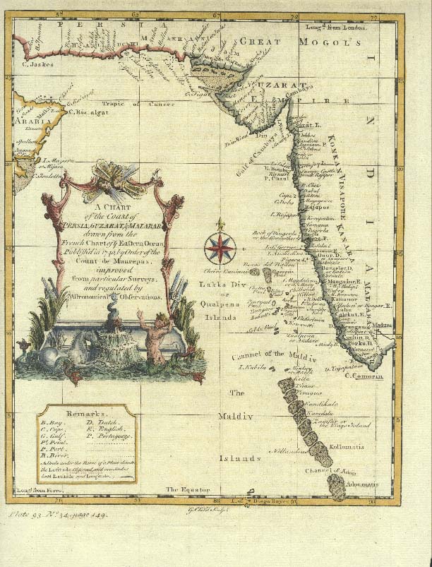
The 1800 Faden Rennell Map provides good detail of the
Travancore lines, as seen below

Now that accepted descriptions and theories of origin have
been laid out, let us peruse Induchudan’s original but extremely complex and
rambling thought process, related to this topic. In fact he starts out with a
clear focus, but loses it midway after having come to a conclusion and later goes
on into the stories of Marthanda Varma’s reign, before finally getting back to
a continuing hypothesis about its antiquity. One thing needs to be mentioned,
Induchudan asks incisive questions to researchers who missed many clear pointer
and demolishes their claims that De lannoy and Marthanda Varma had anything to
do with these lines. But let me not spoil the fun and get to it, step by step.
In this process, I have also referred to Valath’s topographical studies on
Trichur and Nedumkotta (which is actually a translation of sort of Cochins
chief archeologist P Anujan Achan’s survey in 1925-26, walking for 5 days on
foot, surveying the bastion and recording his views).
According to the survey report, the lines originated at one
time at Azhikode, connecting upto Kottamukku in Kodungallur, all now submerged
(that itself gives you a clue about its antiquity!). From there it goes in a
slight zig zag formation until broken by the Chalakkudi River, continuing on
Northeast to foot of the Anamali hills. A wide trench (16’ wide and 20’ deep)
with a bamboo hedge existed to the North of the mud wall (the wall was 30’
wide) and every 3-4 furlongs, resting places were constructed for troops.
Armories were also spread out regularly, so also wells for drinking water.
Spaced every 1 ½ mile were citadels or vattakottas. Sixty camping places were
spread through the length for troops. The Eastern end was at Konur Kotta
vathil, near Chalakkudi. The Western end was at Krishnan Kotta or
Icharaparappu. What the English called Travancore lines was termed Nedum Kotta
(long fort) by the people of the region. It was also known as Jayakotta.
The first pertinent question was how De Lannoy could have
built such a crude and rudimentary structure, with mud, bamboo and so on when
walls and fortifications dating back to 16th century Portuguese work
around Cochin were done with a more modern approach, in stone. In fact Lannoy
had just completed upgrading the mud fort at Udayagiri to one in stone. His work
at the Southern Travancore lines at Arumboly is described by Ward thus - the famous line of fortification called the
Travancore lines is quite demolished, but from its remains it appears to be on
the European plan and was strongly built with stone and lime…
Secondly Dutch VOC engineers such as Von Krause and Cochin
men were also supposedly involved in later extension works, around 1778. Cochin’s involvement and support in this
matter looks suspect as it had already become the vassal of Haider by then. Then
again, the wall would not have helped Cochin’s defense in any way as it cut
through her territory. Attacks from either the south or the North would have
resulted in capitulation for Cochin, so it was not at any time, benefiting
Cochin.
Thirdly, the most pertinent question - why would Travancore
build its lines outside its border, when it was built? According to later
studies, the Lines were north of the Travancore possessions which was a strip
of land (Mukundapuram) in the middle of Cochin’s possessions. In reality the
lines lay in Cochin, during the 18th century. So the simple question
is why somebody would spend a fortune building a fortification in territory
belonging to a third party, who was also a vassal of his enemy? One answer to
this question could be that this was the shortest span for a fortification
between the hills and the sea, looking at the map. So I believe it was just
strategically located, with permission from Cochin, by way of grant of the
villages in which it was situated then, to Travancore, the apparent builders.
According to Velu Pillai, the whole concept of building a
wall came from Marthanda Varma. But according to Mark Lannoy - In 1940, Velu Pillai openly doubted in the Travancore
State Manual whether De Lannoy and other Europeans had played a major role in
the construction of fortifications and reorganisation of the army. He pointed
out that before De Lannoy's arrival many battles were already won by Martanda
Varma. Besides, Velu Pillai argued that the building of fortresses was not
indicated on De Lannoy's tombstone.
Now MV’s involvement is improbable since MV was always beset
with debt after debt, borrowing money from financiers (Balakrishna Das,
Kasinatha Thakathar and Mathu Tharakan) to clear arrears. It is also well known
that he even delayed payments to his soldiers. He had additional issues having
to find money to pay off Chanda Saheb, for which had to borrow from the
British. Later, he had to borrow money to buy the VOC forts on an instalment and
barter basis. All said, there was no way he could have built the wall from
scratch, Travancore never had sufficient funds to build a new wall.
In addition to the above, Travancore state orders show that as
early as 1757, MV had sanctioned an amount of 15,432 panams for clearing wild
growth around the Nedum Kotta signifying that MV saw some purpose in putting an
old wall covered by vegetation to defensive use. He also authorized the
employment of temporary labor to plant thorny bushes near the wall. So it is
clear that the wall was not first built after the Zamorin’s attack of 1761, or
in 1775, but well before that. Here again history shows us that MV (1729-1758)
was busy running North and South fighting wars and tightening his reign. During
that period no Travancore king had sufficient purpose for spending time and
money to build such a long wall, nor did they have any enemies in the North. The
Zamorin’s enmity was only with Cochin, never Venad or Desinganad.
Another clue can be obtained from the correspondence between
Tipu and Dharma Raja in 1789. Tipu wrote to Dharma Raja – “After I possessed
the Calicut country, you erected the lines on part of the Cochin country.
This conduct is not proper, you should erase the lines”. Dharma Raja replied
“You say I have erected lines on a part of the Cochin country and that the Raja
of Cochin has been your tributary fifty or sixty years and you desire me to
demolish the lines which are in the Cochin country. That part of the country
where on the lines are erected, was given to me for that purpose before
the Cochin Raja ever paid tribute to you (i.e. before 1766). I assisted the
Cochin Raja many years ago with troops, who was at war with the Zamorin by
which he was driven out of the country which the Zamorin had invaded and in
return for this assistance he gave me that part of the country and other
portions of land, which I occupy. These lines have been erected 25 years, no
demand all that time was ever made for that part of the country; you know I
possessed it and had lines erected on it, when I was included in the
Treaty of peace which the Honorable English Company made with you. If I had not
a right to it, why did not you then demand it?”
That got me thinking a bit further, imagine the work
involved in making a 40’ high wall, 30 feet wide extending 30 miles (or for
that matter a narrower wall per BS ward’s description). It would take many
thousand men, and many years of work. Neither the English, nor the Dutch, nor
the Cochin and Travancore scribes have recorded this humongous effort in
building it. So it has always been there from ancient times, but was in a state
of disrepair.
What if parts of this wall existed for many centuries before
the advent of the Perumbadappu Swaroopam, the Portuguese and the Dutch? What if
it was a fortification to protect the ancient Kondungallur kingdom? This
potential hypothesis by Induchudan is advanced on the basis that the eastern
extremity had a fort and locale called Konur Kottavathil, which means the
entrance to a kingdom. The only kingdom which it affords an entrance to is the
old Kodungallur kingdom, pre 12th century where the Sangam Cheras ruled
with Vanji as its capital. The wall was perhaps made to protect the Cheras from
southerly attacks, by the Pandyans coming in through the Kottayam gap. To strengthen
this argument further let us now look at the eastern extremity, where the
Krishnan Kotta or Icharaparappu stood. While most of the temples there were
Saivite, three Vaishnavite temples were at that time present in this locale and
so the fort may have got its name from Krishna, a deity in those very temples.
There is one flaw in this argument though. A number of
survey accounts and maps were published before 1760, but not one of them mention
or show the Travancore lines. Perhaps it is so since the wall itself was not apparent
what with the dense vegetation and jungles of the area till MV or Dharama raja
cleaned it all up. Nevertheless, Dharma Raja’s account and Tipu’s comments could
mean an extension of the wall westwards towards Vyipin in the easternmost territories
of Parur & Alangad and that the Eastern parts existed previously. In
conclusion the Travancore rajas, especially Dharma Raja could have worked to
extend (some sources do clearly use the word extend and not build) and
strengthen the fortifications, anticipating an attack from the Mysore Sultans
after the Zamorin families fled to Travancore.
The extensions could have been carried out in 1764 or
thereabouts. VV Valath opines that the Cochin and Travancore kings seeing a
potential enemy in the Mysore sultans commenced the work as a joint operation,
after 1761. Even this would not jell easily with reality. The Palghat king
Kombi Achan, a vassal of Cochin was the person who first invited Hyder to
support him against the Zamorin. The Travancore king MV at around the same time
also wanted mercenary support from Haider, but later turned it down
(infuriating Hyder). In 1766 Cochin became a vassal of Tipu, after Malabar had
succumbed.
As we have discussed already, Tipu was furious that the
influential families of Malabar had escaped him and fled with their immense
fortunes which he could not lay his hands on. Dharma Raja was closely
associated with the Zamroin’s family in asylum and knew what they had faced in
Malabar. During the extensions, he did his best in clearing the bushes, laying
a ditch in front of the lines and some more, but may not have built what Tipu
called ‘the contemptible wall’. Though the expenses could have been huge and we
still cannot find an accounting for such a massive work, let us assume that
Dharma raja did only the essential upgrades. Anyway, so much for the origins.
The first signs of Tipu’s intent to attack Travancore was
seen in March 1788 when Dharma Raja reported to the English that Tipu’s people
were clearing the forests at Angamali, Malayattur and Mankara so that a large
army could march down south. The English warned Travancore not to give any
reason to Tipu for a quarrel. By April 1788 Tipu’s forces were camped at
Kunnamkulam, Palghat & Chavakkad. Tipu then sent his emissaries to
Travancore with words of friendship and a prospective alliance. Dharmaraja
rebuffed them. Tipu countered by stating clearly that he would not accept the
fact that his enemies were provided asylum by Dharma Raja. Dharma Raja replied
that he had indeed provided asylum and that many of the asylees were his
relatives.
When Tipu saw that the wall was being readied up by
Travancore to defend themselves, that too a wall within what he knew was his
vassal’s territory, he was livid and was determined to demolish it. Tipu could
have attacked the newly acquired Travancore forts at Kodungallur if he wanted,
just like Hyder had taken Chetuwa and entered Cochin. He certainly had the
might and the cannons, but that would have riled up the British with whom the
Travancoreans had signed a treaty. Travancore intelligence reported that Tipu’s
plan was to attack not only the lines at two places, but also at Kodungallur.
Note here that for a cavalry, foot soldiers, cannons, rocket
launchers and elephants, you need firm land for easy advance. We do know that
Tipu moved with large numbers of soldiers and equipment. They started out from
Easterly Coimbatore. To climb and come through the ghauts, circle round to
Crangannur, crossing two rivers and move uphill to the eastern corner of the
lines, after facing onslaughts from Dutch forts etc, was definitely not a good
idea. So Tipu decided to first attack the nearest outpost (while coming in from
Coimbatore) on the wall, the Konur Kottavathil, and bring it down. Though I had
covered Tipu’s initial attack or what we called Tipu’s waterloo when he chose
to attack on Dec 29th 1789, we did not quite look at the complete
details. I will get to it in a later article.
Whatever happened to this Nedumkotta? Did it help Travancore
or Cochin? Was it a strategically sound investment? How did Tipu breach
it? I will detail it in the next
article. For now note that it was indeed breached with relative ease by Tipu during
various attacks in 1790 and was later demolished by the British. As time went
by it mostly vanished with the ravages of weather and during various
construction phases resulting from burgeoning development in the region. Even
though it was a protected monument, not much can be seen today. What little remains
is well reconstructed by Sasi Kadukkapilly in the linked video which provides
you much appreciated details and his impression of the Nedumkotta as
superimposed on Google maps.
References
The Golden temple – V T Induchudan
The Golden temple – V T Induchudan
Geographical and Statistical Memoir of the Survey of
Travancore and Cochin states - BS ward, PE Connor
Keralathile Sthalacharitrangal – Trissur, VV Valath
The Cochin state manual
The Malabar Manual - Logan
A history of Kerala – KM Panikkar
Kerala under Haider & Tipu Sultan – CK Kareem
Rama Varma of Travancore – Dr B Shobanan
The Kulsekhara Perumals of Travancore - Mark De lannoy
My sincere thanks to Einstein Valath for helping me with the
pages from Valath’s book and Erik Odegard of Leiden University for translation
assistance of Angelbeek’s report. I will cover the latter when writing about
the attack, in more detail and after receiving some additional material from the
British archives. Deepti Murali has covered the topic of the attack as recorded
by Knox (the source links in that article are erroneous) can be seen at this
linked article. Most of all thanks to the efforts of Sasi Kadukkapilly in
making a video survey of what remains of this interesting fortification. It is
an invaluable effort.
7 comments:
Maddy sir,
As usual well researched topic,.indeed apt to know the nedumkotta which was mentioned a lot in tippu Vs Travancore fight
Samoothiris during their 600 years of rule was over riding Kochi many a times and kept Kochi in tenterhooks
There was no mention of this kotta in any of the samootris onslaught in Kochi territory
But during 1728 to 1758 Marthanda varmas rule, he started reaching Kochi suburbs like, paravur.aluva, perumbavoor, the fight with Kochi in cherthala was turning point where Travancore killed Kochi padathalavan the vailant ettikelumenon and took Komi achan in captivity , Komi achan who was so intelligent understood in his jailed period ,Kochi can,t withstand Travancore forces , when he got released he advised the then Kochi raja to have treaty with Travancore, thus famous achan pramanam was signed at suchintram temple between Kochi raja and famous dhararaja aka karthika thirinual ramavarma
The treaty allowed tranvacore in control of parur aluva perumbavoor all acquired territory in turn Travancore must help Kochi to prevent samootris attack
As part of the plan two battalions under dilnoy and famous padathalavan ayyappan Marthanda pillai attacked sammothiri forces at mapranam near erijalakuda in 1762, there also the nedumkotta lines were not mentioned in the story of attack, the forces Travancore under dilony and pillai formed like a scissor and samootris forces in between., Samoothiri and his Nair soldiers had to run , after crossing bharatapuzha
After this defeat.samoothri had to visit Travancore and paid compensation to Travancore ,.and also samootri might have understood imminent tippu attack.and wanted peace with Travancore to fight tippu
The farsighted dhararaja wanted some kind of protection for his territory asked famous engineer and veteran dilnoy to build kotta . Even after kayamkulam attack during mvarmas time, travacore got right to install a sthani Nair from travcore as head of temple administration in koodalmaikayam temple erijalakuda ( called thachudaya kaimal,) so the might of travacore forces was so hight after defeating samoothri and all out help from brtish and also economical help from people who ran away from samootri kindom also might have helped him to built a fort which he might have felt need of the hour on military strategic lines , the brtish also wanted a peace travacore for smooth trade,they also might have contributed financially
The remains of lines were there during chera dynasty also has to take with pinch.of salt as story of chola chera fight also.not mentioned about such a kotta
When we read later trancore history after the demise of karthika thirinual, the mounting debt they owe to British as result of war with tippu and also the expense incurred for making such mammoth structure running intokilometers so I have the strong belief it was dilnoy,s architecture.under.command from raja karthika thirinual ramavarma
thanks jayan
for your detailed comment.
If delannoy built it in any period after the 1761 Zamorin attacks, why did marthanda varma allocate money for its repair and the planting of thorny bushes in 1757? That was the interesting part.
Yea true! But still, intriguing part is except battle , tippu Vs travacore , rest other history whether chera chola fight or sammothiri earlier attack on Kochi this pahayan kotta( as historian sreedhara Menon remarked ) never found mentioned
""You know, most people are under the impression that the Japanese were forced to surrender, after the atom bombing of Hiroshima and Nagasaki. It suited the US stance and curiously the Japanese stance even though the reality was that the surrender was forced when the Japanese noted that they had lost an ally Russia, once and for all, and were isolated. ""
Maddy sir, I think you meant Japan surrendered after it lost Germany as an ally . Russia was not an ally of Japan , they had history of conflict
Hi Sorrya narayan..
and therein lies the tale...The use of the word ally was not perhaps quite right, but in the pacific theater Russia were neutral with respect to Japan.
Tsuyoshi Hasegawa's studies (racing the enemy) pointed out that the twin bombings were not necessarily the cause of Japanese surrender, but the refusal by Stalin to come to Japan's help and request for mediation. He mentions - Japan’s leaders were in fact quite savvy, well aware of their difficult position, and holding out for strategic reasons. Their concern was not so much whether to end the conflict, but how to end it while holding onto territory, avoiding war crimes trials, and preserving the imperial system. The Japanese could still inflict heavy casualties on any invader, and they hoped to convince the Soviet Union, still neutral in the Asian theater, to mediate a settlement with the Americans. Stalin, they calculated, might negotiate more favorable terms in exchange for territory in Asia. It was a long shot, but it made strategic sense.
After the bombing - the Japanese leadership reacted with concern, but not panic. On Aug. 7, Foreign Minister Shigenori Togo sent an urgent coded telegram to his ambassador in Moscow, asking him to press for a response to the Japanese request for mediation, which the Soviets had yet to provide.
Very late the next night, however, something happened that did change the plan. The Soviet Union declared war and launched a broad surprise attack on Japanese forces in Manchuria. In that instant, Japan’s strategy was ruined. Stalin would not be extracting concessions from the Americans. And the approaching Red Army brought new concerns: The military position was more dire, and it was hard to imagine occupying communists allowing Japan’s traditional imperial system to continue. Better to surrender to Washington than to Moscow.
Quick source
http://archive.boston.com/bostonglobe/ideas/articles/2011/08/07/why_did_japan_surrender/
sorry soorya narayan,
spelt your name wrong.
also check this out
http://foreignpolicy.com/2013/05/30/the-bomb-didnt-beat-japan-stalin-did/
Thanks a lot Sir
Post a Comment