

Conolly and the Calicut Canal
Posted by Labels: Canoli Canal, Conolly, Conolly murder, Malabar - English period 1800-1900
The Canoli Canal of
Calicut
The story of this Canal is quite engaging. Most people believe
that the Elattur - Kallai canal as it was formally known was the brainchild of
the man who lent his name to the project, the result of which was eventually
called the Canoli Canal or more correctly the Conolly Canal. Well, the idea
germinated well before that actually and what most people also do not know is
that while Conolly lived to construct the canal, he also lost his life due to
an argument over a simple monetary issue arising from this canal construction.
To get to the scene of the story, we have to go to a Calicut
which was quite different from the bustling entrepot it once was many centuries
ago. The Arab and Chinese traders had gone, the visitors from other nations had
declined to a trickle and barring pepper, coir and timber, held little value to
the outside world. The Zamorin was no longer in power and the new lords, the
British, quickly flourished in other metropolises such as Bombay, Madras and
Calcutta. Calicut which had once been their first port of entry had given way
and was mostly forgotten, now home for some British and Anglo Indian residents
amidst the local populace. Trade continued, a few factories struggled, but it remained
simply the district headquarters of a locale abundant in natural resources, not
anymore important from a strategic or military perspective, the Zamorin and
other lords having been subjugated. It was quite different from the Calicut we see
today, and mostly a ‘not happening’ place where the posting such as that of a
collector could be viewed as a punishment or banishment. This was where Henry
Valentine Conolly was posted to, in 1840. Calicut I understood, at that point
of time had probably 20 Europeans living in the West Hill area. Burton pitied
the Malabar expatriate’s life in September, during the monsoon; as he remarked “what a dreary life they must be leading,
with no other sounds in their ears but the roaring wind, the pelting of the
rain and the creaking of the palm trees.”
Calicut was naturally fortified, I suppose, for it was only
accessible from the sea and through a few cart roads from inland. Beypore was a
nearby port which provided landing facilities for deep sea ships and so if
somebody wanted to come from afar, places such as Bombay, they sailed down to
Beypore and then boarded a bullock cart to jerkily reach the capital of the
Zamorins, where the bigwigs lived and where the big bazar was situated. Much
later the first southerly terminus of the railway was also situated at Beypore.
From Calicut they had a road to Ponnany and on to Palghat, and from Beypore to
Nilambur and on to Ooty. There was also a road to Mahe, Cannanore and
Tellicherry, but all these were traversed by carts or with palanquins if the journey
was short. So but naturally the more comfortable trip was by sea.
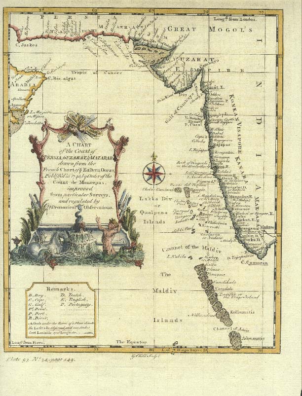
The very concept of river navigation from the North to the
South tip of Kerala was originally detailed by HS Graeme in his 1822 report,
highlighting the fact that this was a perfect method during monsoons when
seafaring was difficult and of course the roads potholed and treacherous. In
his report he identified the continuity of a water passageway between Quilon
and Calicut. He also mentioned that the two rivers, Korapuzha and Beypore River
(Chaliyar) which bound the northern and the southern extremities of the Calicut
taluk were convenient for transportation of firewood to the coast, and would be
useful for conveying grain to the port of Calicut. Another reason was that pepper
and other spices growing in the north-eastern parts of Wayanad hills were
brought to the coast through Kuttiady River and Korapuzha. Hence the opening of
a canal could facilitate commodity flow to Calicut and other ports.
Subsequent collectors and administrators worked on this
concept, namely Conolly and Robinson, to create the canals and connect up the gaps
in order to create such a network. But let’s take a look at the water
passageways which existed.
As the eloquent gazetteers - Innes and Evans wrote - The river system of Malabar, in itself as
simple as it is extensive, is complicated by the ramifications of a network of
backwaters near the sea. Apart from the three great tributaries of the Cauvery,
which drain the Attapadi Valley and nearly the whole of the Wynaad taluk, all
the rivers of the district flow down from their watersheds in the Western Ghats
to the Arabian Sea. With the single exception of the Ponnani River, none of
them exceeds a hundred miles in length; and only when the south-west monsoon is
blowing, and the rainfall on the ghats is measured in scores of inches, do they
roll down in a heavy flood. For nine months in the year the majority are
shallow streams and, unable to force their way through the sand banks formed
along the coast by the persistent action of the littoral current, lose
themselves in back waters and creeks and arms of the sea. Many of these
backwaters have been linked up by artificial canals, forming important means of
communication; and, in tie south of the district, there is an uninterrupted
waterway from Tirur to Travancore.
So much for the river system in Malabar, and how it
connected to the South. Now how about the North?
The Valarpattanam
River in Chirakkal taluk, though not the longest river in Malabar, probably
discharges into the sea the greatest volume of water. The wide and deep estuary
of the river, which forms the port of Valarpattanam or Baliapatam, opens out on
the north into a backwater, into which falls the Taliparamba River with the
drainage water of the north-east of the taluk. The Sultan’s canal connects this
backwater with the creeks and arms of the Mount Deli River, which again joins
the Nileswaram River. The major portion of the last-named stream lies in South
Canara, but for some miles it is the northern boundary of Malabar. So the first
of the canals was the so called Sultantodu or Sultan Canal built by the Ali
Raja (Ali Raja built it with Hyder’s approval) in 1766, a 2 mile long canal to
link the lagoons of Madayi and Irukkur, thus enabling uninterrupted
communications between Nileswaram and Kannur. This canal is believed to be the
first known initiative to link inland water bodies. The Anjarakkandi and Mahe
rivers, which drain the rich pepper country of Kottayam and northern Kurumbranad,
are navigable for a few miles only front their mouths, and are unconnected with
one another and with other streams. But the Kotta River in the center of the
latter taluk, which takes its name from a fort, which commanded its entrance in
the days when the Kottakkal pirates harried the shipping along the coast, opens
up a long chain of inland waterways.
A short canal connects the river on the north with Badagara,
the chief port of Kurumbranad; and the Payyoli and Conolly canals links it on
the south with the Agalapuzha, Elattur, Kallayi and Beypore rivers and with
Calicut, the capital of the district. The canal proper, which was constructed
by HV Conolly, Collector in 1848, consists of a cutting about 3 miles in length
running through Calicut city and connecting the Elattur or Korapula and Kallayi
rivers. It thus forms part of the line of water communication from Badagara to
Beypore.
Continuing on, the
Beypore River or Chaliar, 96 miles long, famed of old Beypore for its
auriferous sands, is the only river of Malabar which draws a great part of its
waters from above the crest of the ghat ranges. It has three main branches,
which unite a few miles above Nilambur. The three streams, reinforced by many
large feeders, unite in the heart of the famous teak plantations in the middle
of the Nilambur valley, and thence flow into the sea at Beypore, six miles
south of Calicut, once the terminus of Madras Railway.
Now we get to know another purpose of the Conolly Canal,
other than that of linking the river systems of the North to the Chaliyar. Vast
quantities of timber are floated down from the Nilambur forests to Beypore, and
thence through the Conolly canal to Kallayi, close to the Calicut bazaar, becoming
one of the greatest timber ports in India.
The Kadalundi River, which is connected with the Beypore River
by a creek, flows down through the Eranad and Walavanad taluks from the wilds
of the Silent Valley, and empties itself into the sea at Kadalundi after a
course of some 76 miles. An attempt, continued down to 1857, was made by
several Collectors to complete an uninterrupted system of water communication
from Badagara in Kurumbranad to Trivandrum in Travancore, by constructing a
navigable canal from this river to one of the arms of the Ponnani river; but the
cutting, though still in existence, is impassable except for the smallest boats
at the height of the monsoon. The oily mud, which oozes up from below into the
water of the canal, is the great obstacle to navigation. In rainy weather the
Kadalundi River is navigable for small boats as far as Karuvarakkundu at the
foot of the Ghats, but in the dry season they cannot ‘ascend higher than Puttur
amsam in Ernad taluk. The Ponnani River, the longest of all the rivers traverses
the taluks of Palghat and Ponnani, skirts the southern boundary of Waluvanad,
and, after receiving between the railway stations of Pallippuram and Kuttipuram
the drainage water of the last taluk from its great tributary, the Tutha River,
discharges itself into the sea at the port of Ponnani. North of the town a wide
reach of backwater stretches away to the railway system at Tirur, and to the
south the river is linked by a canal with the Veliyanorod and Chettuvayi
backwaters, and ultimately with the long line of waterways that ends only at Trivandrum.
Though somewhat boring to the lay reader, the foregoing paragraphs
explain to you how the waters formed a river-sea-canal link from the North of
Malabar all the way to Travancore, if not always, at least during the monsoon
season when the rivers were full and upto the brim. The three canals which
linked them all were the Sultan Canal in N Malabar and the Payyoli and Conolly Canals
in Malabar and the Aleppey Canal.
In 1845, the detailed project report was submitted to the
Madras government and received administrative sanction in 1846. In 1848, the
Canal was commissioned. Though the extension work of Canal was stopped after
the murder of Canolly in 1855, Robinson who took over, supported the completion
of the project.

Now let’s look at the commercial reasons driving Conolly’s
canal project. We discover that it was mainly due to teak wood requirements for
ship construction. But well before all that started the appropriation of the
forests by the British, step by step. In Malabar, as well as in some of the
adjoining parts of Kanara, most of the land had from time immemorial been in
the possession of large landlords, who claimed proprietary rights over the
forests as well as over cultivated lands. Tippoo Sahib, the Sultan of Mysore,
however, had, while he ruled these districts, in an arbitrary manner set aside
these rights, particularly the right of felling timber, which he claimed as a
Royal privilege. At first these districts were placed under the Government of
Bombay and their wealth in timber attracted the attention of that Government.
In August 1800 the Court of Directors authorized the Bombay Government, to
assume the right of felling' timber on behalf of the East India Company.
It was in 1844 that HV Conolly, established Teak plantations
in a large scale near Nilambur with a point of view "to replace those
forests which had vanished from private carelessness and rapacity."
Conolly determined to raise Teak forests on a large scale on Government
account. After strenuous efforts, he obtained and selected an area of around
19,000 acres, where teak cultivation started, following a difficult phase with
respect to getting the seeds to germinate.
Conolly commenced his experiments in 1842, and in 1844 he
had raised 50,000 healthy seedlings. By 1878 the area planted up aggregated
3,436 acres, and the oldest compartments, which at that time were on an average
33 years old, were stocked with a dense wood of Teak poles nearly 100 feet
high. These poles found a ready market at Calicut and so some areas were
cleared and replanted, and soon a species of mahogany was also introduced as a
mixture, a move in the right direction, for it was found that Teak thrives best
when growing in company with other trees.
The justification continues - The selection if land was based on proximity to the river going
towards the sea. Mr. Conolly had selected for his operations the valley of the
Nilambur River, which runs into the sea at the port of Beypur. The rivers are
navigable by rafts up to January, and below Mambat, the most westerly point of
the Plantation, the navigation is so easy that the largest rafts can be managed
by one man. The river which drains the valley empties itself into the sea at
Beypore, and 4 miles from the mouth of the river a navigable canal communicates
with another river which traverses the heart of the Calicut Bazaar, the best
timber market on the west coast. This river is connected with the Calicut
roadstead by a bar always open, so that the cost of conveying timber from the Plantations
alongside ship may be regarded as at a minimum. That was the reason behind
the construction of the Canal.
To construct the canal, a cut was made by Conolly through a
high ground to connect the Ponnani and Kadalundi rivers. At that time, it was
called the Calicut Canal. The Conolly canal passed through the amsams of
Kasaba, Kottuli, Kachcheri, Edakkad, Karannur, Makkada and Elattur, and connected
the Kallayi with the Elattur River. The British administration report of 1885 mentions
plans to construct further canals to link the inland links all the way down
south.
An extensive seaboard, with backwaters running parallel to
it, affords easy means of transit; whilst the artificial canals made to connect
these backwaters give a continuous water communication along the coast, of 77
miles from Cochin to the railway station of Tiroor, of 43 miles from Beypore to
Badagara, and again of 22 miles from Belliapatam to the frontiers of South
Canara. Records mention the following - The
canals are on an average between 10 to 12 feet broad, and 1 or 2 to 3 and 4
feet deep at low water, and are intended only for small boats. None of them are
in a state of efficiency at all times, and 8 miles of cutting are required to
connect the Tanore Canal with the Kadalundy and Beypore rivers. It is, however,
in contemplation to complete a good navigable canal from Tiroor to Cochin, and
push the work on eventually from Badagara to Mahe, Tellicherry, and Cannanore.
The land acquisition for the project in Calicut did not
prove to be a big issue for various landlords and the Zamorin gifted the land
to Conolly. The owners of agricultural land of the neighborhood insisted that
the canal be used supply them clean water for irrigation, and this was agreed
to in principle, with the added condition that the EIC would also implement
steps to block any ingress of salt water into the agricultural lands. The work
started in right earnest and the wage (for the day workers) for the hard labor
of excavation and digging was supposedly a big feast at the end of the day. A
new mud bund or lock was created at the sea entrance and this was called
Puthiya Chira (nowadays known as Puithiayara) to stop salt water ingress.
Between conception in 1845 and completion in 1848, many people of Calicut were
involved in its construction. As a researcher J Shinoy mentions - The plan and estimate of the canal was
submitted in 1845 and got approval in 1846. The fast track way of completion
and the opening of the canal in 1848 and the subsequent busy traffic
experienced in the canal showed the momentousness of the absence of a water
transport system inside the city till the day.
The Connolly canal also had an extension to the Valiyangadi
or Big Bazaar which connected to the Kallayi River. This link, known as ‘Bazaar
Canal’, was utilized for commodity movements from and to the Valiyangadi. A
later collector, the famous William Logan was the person who decided the
location of Calicut’s railway station (the Chaliyam railway station lost out in
the bargain) upon what once was the route of the dried up Robinson canal or the
Bazar canal. In fact he chose the site due to its proximity to the Robinson
Canal which he thought could be utilized for bringing the construction
materials to the site and it can also as a drainage for the proposed railway
station. As per the settlement records a space known as Puzhavakku existed
facilitating this. The field study mentioned by Shinoy, corroborated with the
archival records identified and confirmed the huge drainage connecting
Valiyangadi, which go further south by passing through the present railway
colony premises, as the remnants of the old Bazaar canal.

Following the murder of Collector Conolly, further extension
of the canal network and the last parts of the Elathur Kallayi canal project
was stopped till Robinson decided to complete it, though not all the
extensions. The canal was also used extensively for passenger and goods
movement by small boats and a jetty was built at Eranhipalam, but in 1872 or
thereabouts, major issues cropped up with damages to the banks and resulting
flood of salt water into the fields. The EIC and the British government later
washed its hands off such issues, stating that the canal was built for
transport purposes and not irrigation. The Eranhipalam jetty stood next to the
present road bridge and its upkeep was for a while taken care of by a
contractor named Alikoya. The canal administrators levied a small toll of 1
anna on boats traversing it. Boats ferried back and forth with goods, mail and
passengers. The canal was also busy with large paddy boats belonging to wealthy
merchants of the city, thatched with a semi-circular roof of leaves, which carried
1 to 4 tons of cargo to Calicut port.
By 1924, Canolly Canal had over 772
country boats and 2541 rafts plying through it. After the road transport system
strengthened, the canal's glory diminished.
So much for the Canal itself. But how did Conolly’s murder which
happened in 1855, have anything to do with the Canal? It goes back to the confession
of one Malakel Mammu who harbored Conolly’s murderers on the days preceding the
attack. Mammu actually had two houses situated some 70 yards apart in different
compounds, both stood on an open space to the east of the canal, about three
quarters of a mile due-east of Conolly’s house, which was nearly three miles
due-north of the town of Calicut.
The Mappilas who murdered Connolly were escaped convicts
from Calicut Jail (from the Town Jail, not the courthouse) called Valasseri
Emalu, Puliyakunat Tenu, Chemban Moidin Kutti and Vellattadayatta Parambil
Moidin. They had escaped from a prison working party on the 4th of August 1855,
spent the following month on the run in various houses in the foothills of the
Ghats. After a prayer at the Mambram Thangals shrine, they hid in Mammu’s house
for several days, before taking vows at a Nercha ceremony where they sang a
song called Moideen Mala Pattu. During this session, their war knives were
passed through incense smoke.
Mammu had his own grudge with Conolly over a simple matter
of unpaid arrears, and is explained as follows by the investigators - He
(Mammu) had also had a good deal of intercourse with Mr. Conolly since the
canal was begun. On account of his being
in default for some work he undertook on the canal, Mr. Conolly was forced to
bring a suit against him and obtained a judgment for the money (Rupees 156/-). As
Mammu had little property, Mr. Connolly out of compassion recovered the sum
(except interest which he forgave him) by keeping back the rent for the
temporary Jail. Mammu in a petition in October 1854 demanded this rent
which was refused by Conolly since Mammu himself owed money to Government,
telling Mammu he should think himself lucky to be let off what he owed. Collett notes that this was the background
of Mammu’s personal bad feeling towards Mr. Conolly.
You may now wonder what this temporary jail and its rent was
all about – The investigator Collett hastens
to explain - While the canal was being made, a number of prisoners were located
in a shop. Mammu used to exert himself to procure security for those confined
in default, and himself lately went security for a bad character from a distant
taluk. I am satisfied from inquiries that the Calicut convicts have regular
agents in different places about Calicut (usually shopmen in the neighborhood
of their working places) to whom their relatives entrust money and provisions,
and where, with the connivance of the Peons they communicate, with whomever
they choose. Mammu was, Collect expects, one of these agents. So in
summary, Conolly withheld a sum of Rs 156/- from Mammu for defaulting in his
work in the Canal project by not paying him rent for jailing some coolies.
Such was his rage that Mammu got involved in the detailed
planning of the next steps to murder Conolly. He was also instrumental in ferrying the
killers a few days before the murder across the river and also after the event.
It became clear that Mammu (from the evidence provided by his wife and son) procured
them food and shelter on the 6th September on their return. It was also
established that he received a sword from one of them, and that he took
infinite pains at a subsequent period to conceal two swords and a bayonet which
were eventually discovered by the Police. He likewise displayed an extreme
anxiety to remove evidence of his having communicated with the assassins, and
together with his brother and another prisoner endeavored to suborn some of the
witnesses to give false evidence.
On the evening of Tuesday, the 11th Sept 1855, the murderers
hacked Conolly to death. I had covered the various aspects, motives and
background in an earlier article, but as you saw above, Mammu (his wife Cunyachy
and son Kungi Peri), who had profited initially from the Canal work, was a
co-conspirator in the murder plot and its success. Malakel Mamu was transported
to the Chicacole jail in Kalingapatanam - formerly in the Ganjam district and
in today’s Andhra Pradesh (Srikakulam) where it appears he passed away. All his
land and properties were attached by the Collector.
References
Urbanity and spatial processes – Jesinth Shinoy (with special
thanks and acknowledgement for the original work)
Madras district gazetteers, Malabar - CA Innes, FB Evans
Transport and communications in India prior to steam
locomotion Vol 2 – Jean Deloche
Indian Forestry - Sir Dietrich Brandis
Manual of the Administration of the Madras Presidency
A Statistical Atlas of the Madras Presidency
Malabar Paithrukavum Pratapavum – article on Canoli Canal by
TB Seluraj.
Kozhikodinde Paithrukam – TB Seluraj
Pics – Conolly canal map – US Army map service, April 1959,
Conolly Canal - By Vengolis - Own work, CC BY-SA 4.0
4 comments:
My thanks and appreciation.
Your work is a joy to read.
I think the Special Commissioner, H. S. Graeme's report mentioned above was in 1822. (a tiny slip-up, I guess).
Your work is a joy to read. My thanks and appreciation.
I think the Special Commissioner, H. S. Graeme's report mentioned above was in 1822 (a tiny slip-up, I guess)
Thanks, Chinnu..
appreciate it, yes I made the correction!
Many thanks for the well researched article. It caught my attention while i was trying to trace the alignment of the coastal waterway on a map.
Unfortunately the wikipedia article of Conolly gives a very communal narrative of his murder which likely needs to be corrected https://en.wikipedia.org/wiki/Henry_Valentine_Conolly
Post a Comment